
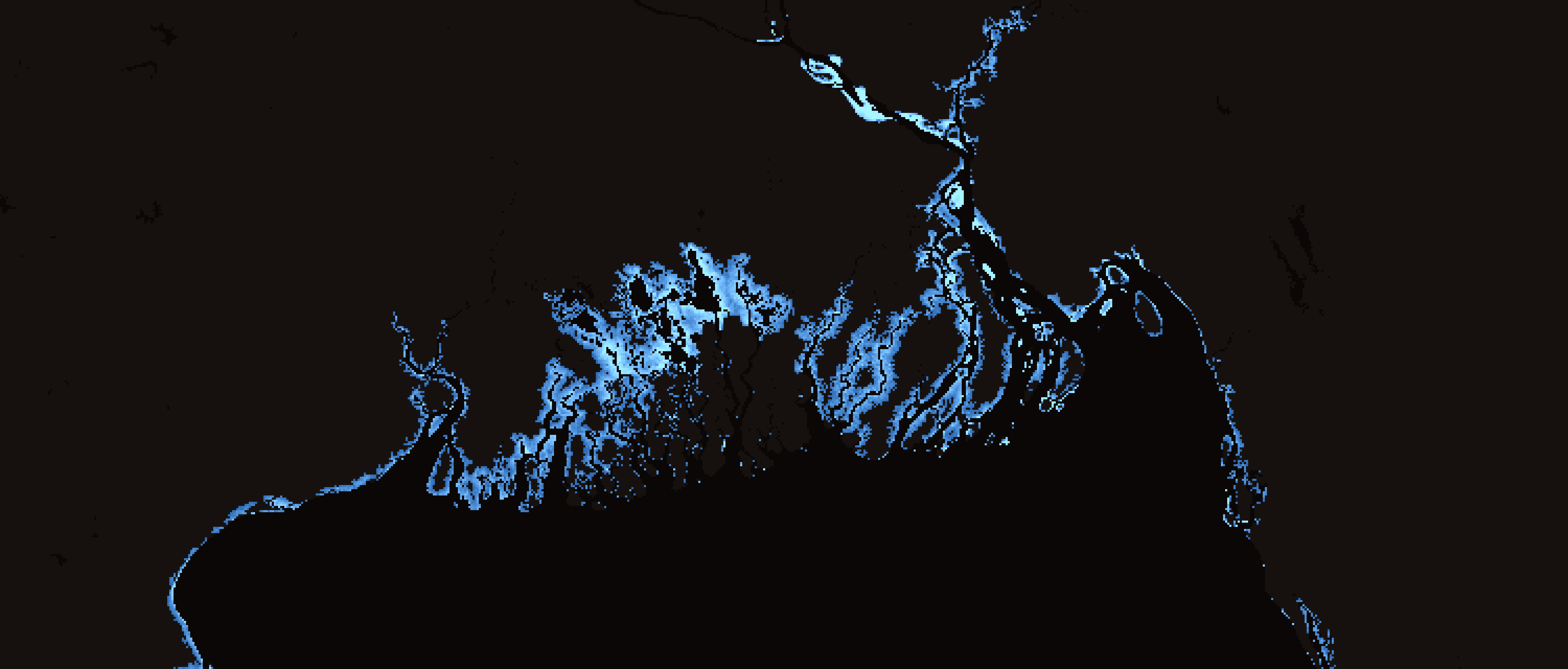
Explore Wasser by discipline
The problem, and the fix
Where did that number come from?
Any spreadsheet will give you a peak flow. What it will not give you is an answer six months later, when the reviewer asks how you got it. Four inputs go into that figure. Here is what travels with each one.
At the design review
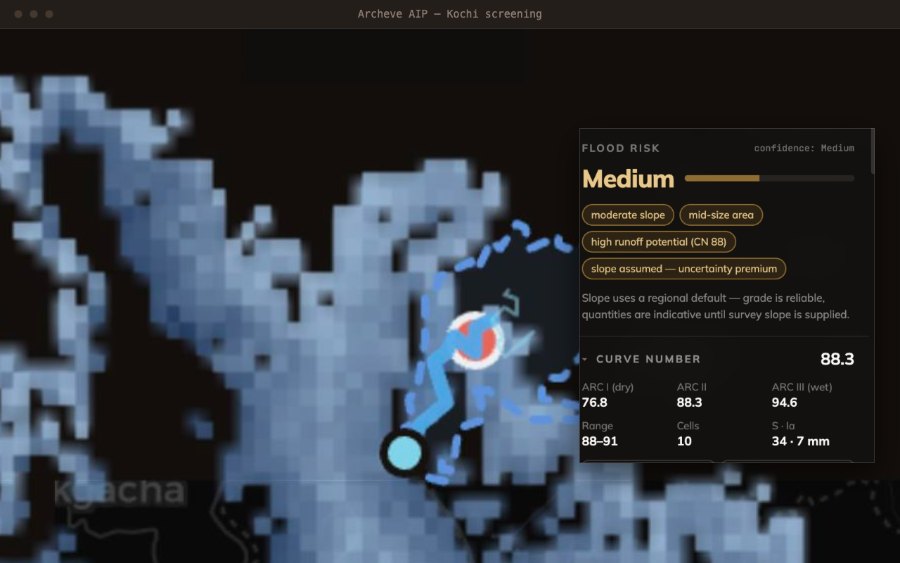
Where does the 88.3 come from?
Six months on, by hand
You reconstruct it, or you defend it from memory.
The soil group was weighted by area in a spreadsheet that has since been edited. The judgment was sound. The record of it was never written down.
Six months on, screened in Wasser
GCN250 · 250 m · ARC II
Area-weighted, with the catchment it was averaged over, the licence it came under and the date it was pulled. Already on the sheet you handed in.
Same sources, same methods, same limits. The difference is whether the paper trail exists when you need it.
The platform
Three ways in, one engine. Screen a project in the browser and it is the same screening on the desktop.
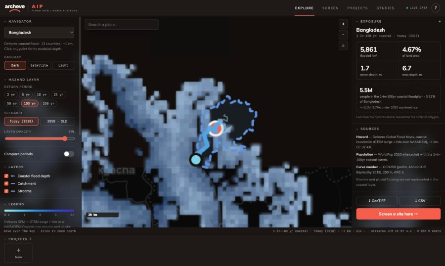
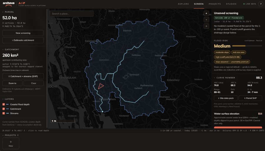
A screening, in three steps.
Draw a parcel and get a full hydrology screening in about a minute — curve number, design storm, peak flow — with every assumption shown.
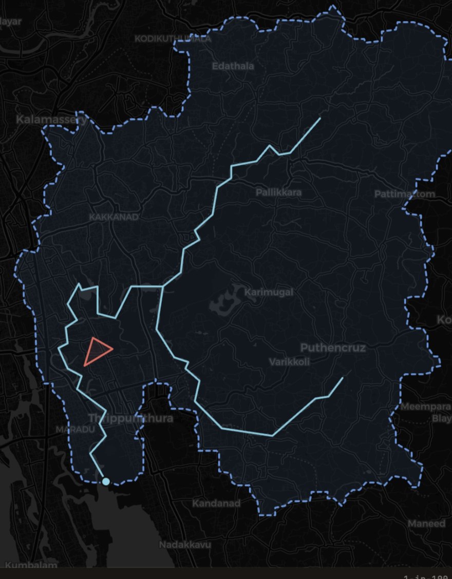
We tell you how confident to be.
The engine solves each cell under low, central and high rainfall, and marks the fringe where those three disagree.
If the DEM is coarse, if slope had to be assumed, if the IDF is a regional preset rather than gauge data, the screening says so and the band widens.
A single number would be easier to read and harder to defend. Your professional liability rests on the second one.
Read the methodologyDesktop application
Install Wasser
The same engine as the web app, running as a real application — its own window, your own elevation data, layers you can order and style, and a project you can close and come back to. The way QGIS or Google Earth Pro sits on your machine, rather than a tab you keep open.
- 1.0.0 version
- Free unmetered
- Code-signed not notarized
- Offline after first run
Your own DEMs
Register a folder of survey rasters once; any that cover the site you draw are offered, finest first.
Works with no signal
Tiles, terrain and hazard data are kept on disk as they pass through. Store a site before you travel.
Layers, not one view
Order, style, hide and inspect every layer, with its source, CRS, resolution and date on the panel.
Room to compute
No browser tab memory ceiling, and a solve keeps running at full speed when the window loses focus.
All buildscode-signed · not notarized
First launch shows a security warninghow to get past it
The builds are code-signed but not notarized, which costs $99/year. QGIS, Blender and Inkscape ship the same way. Nothing is wrong with the file — macOS simply cannot phone Apple about it.
macOS — using the installer
- Download Install Archeve Wasser.command above (4 KB).
- In Downloads, right-click it → Open, then Open in the dialog.
- It picks the right build for your Mac, installs it and opens it. No further warnings.
macOS — without Terminal
- Drag the app into Applications and double-click. It will be blocked — that is the step that makes the next one appear.
- System Settings → Privacy & Security, scroll to “Wasser was blocked…”, choose Open Anyway.
Right-click → Open is often suggested and is not dependable on Sonoma — and it does nothing at all while the app is still in the disk-image window.
Windows
- SmartScreen shows “Windows protected your PC”.
- Choose More info, then Run anyway.
Once only, on either platform. After that it opens like anything else.
The web app is unchanged and stays free. Nothing moves to the desktop, and a project screened in the browser is the same screening either way.
Almost nothing.
Screening, the flood atlas, the 3D terrain and water view, your own DEM uploads, and every export — CSV, GeoTIFF, shapefile and the printable report — are free and unmetered. No card, no trial, no seat count.
Water-surface elevation map
Approximate coastal water level — DEM plus modeled depth — clipped to your parcel as a 30 m GeoTIFF. Coastal sites only.
Availability is checked before you pay — if no coastal water reaches your site there is nothing to sell, checkout refuses, and you cannot be charged for an empty raster.
Engineered studies
When a screening is not enough, the Archeve studies desk takes it to a modelled deliverable. Scoped and quoted separately. Donations, if you leave one, are optional and go to running costs.
Talk to the studies deskQuestions, answered
The ones an engineer asks before putting a number on a drawing.
Ask us something else →What does “screening grade” actually mean?
It tells you whether a site is worth a survey and a proper modelled study, and roughly what you are dealing with. It does not replace either, and it will not stand up as an approval basis.
Does it cover riverine or pluvial flooding?
No. The hazard layer is coastal — storm surge and tide. Riverine and pluvial flooding are not represented in it. The screening side does give you catchment runoff and peak flow, which is a different question from mapped river inundation.
Can I use the IDF presets for design?
Not for design. The regional presets are not gauge data. Replace them with the municipal or authority IDF for your location before anything goes on a drawing. The screening flags this on the panel, and it widens the confidence band while a preset is in use.
Why is almost all of it free?
The hazard, soil and terrain layers are published datasets under open licences, and one screening costs us very little to run. Archeve is a consultancy. We built this because we needed it. The one paid item is the water-surface elevation raster at $10 a site, and engineered studies are quoted separately.
What if no coastal water reaches my site?
Then there is nothing to sell you. Availability is checked before payment, checkout refuses, and you cannot be charged for an empty raster. The screening itself still runs — runoff and peak flow do not depend on the coastal layer.
How accurate is ~1 km on a 52 ha parcel?
A ~1 km cell is bigger than most parcels, so what you get is the depth of the cell your parcel sits in, not a survey of the parcel itself. That is why the reading carries a band instead of one figure, and why the desktop app lets you bring your own DEM.
Who is behind it?
Archeve, a civil engineering consultancy specialising in water infrastructure, environmental engineering and sustainable design, with offices in Bangalore and Dubai. Wasser is the software arm.

Know the water before you build.
Open the atlas, screen a site, and come back to it whenever you need to.
Free and unmetered · no card · no seat count